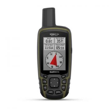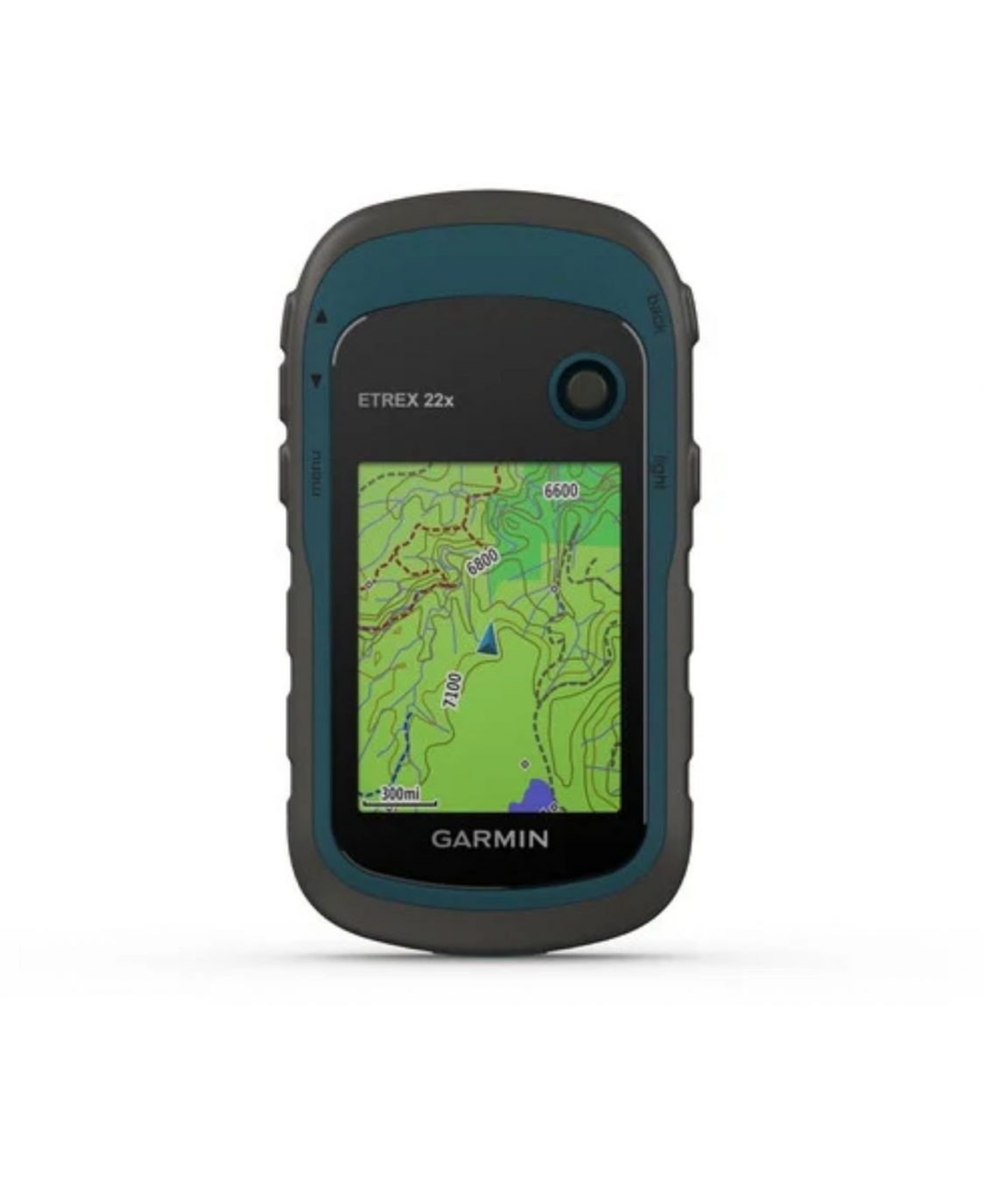
Garmin eTrex 22x Handheld GPS
 or 4 payments of $76.50 with Wizit learn more
Explore Confidently with the Reliable Handheld GPS
- 2.2” sunlight-readable color display with 240 x 320 display pixels for improved readability
- Preloaded with TopoActive maps with routable roads and trails for cycling and hiking
- Support for GPS and GLONASS satellite systems allows for tracking in more challenging environments than GPS alone
- 8 GB of internal memory for map downloads plus a microSD™ card slot
- Battery life: up to 25 hours in GPS mode with 2 AA batteries
eTrex 22x offers the same ease-of-use, durability and affordability that the eTrex handheld GPS series is known for — along with preloaded TopoActive maps. These devices are perfect for ATVs, bicycles, boats or hiking.
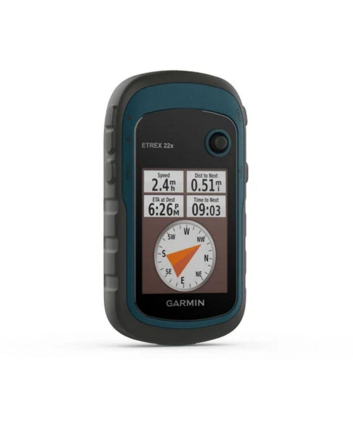
See the Way
eTrex 22x offers enhanced 2.2”, 65K color, sunlight-readable displays. Durable and water resistant, these handhelds are built to withstand the elements.
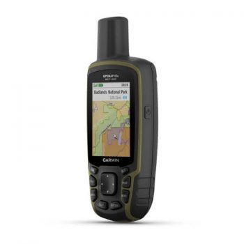
Explore the Terrain
The eTrex 22x and 32x handheld devices come preloaded with road-routable TopoActive maps that feature streets and trails so you can take the journey off the grid. Now you can know your surroundings — such as waterways, natural features as well as buildings, international boundaries and more. You can also find thousands of points of interests, including shops, restaurants, universities, car parks and accommodations.
Keep Your Fix
The eTrex 22X uses both GPS and GLONASS satellite systems so the receiver has the ability to track in more challenging environments than GPS alone.
Out of stock
Specifications:
General
- Physical dimension: 5.4 x 10.3 x 3.3 cm
- Display size: 3.5 x 4.4 cm; 5.6 cm (Diagonal)
- Display resolution: 240 x 320 pixels
- Display type: 2.2″ Transflective, 65K color TFT
- Weight: 141.7 gm with batteries
- Battery type: 2 AA batteries (not included); NiMH or Lithium recommended
- Battery life: 25 hours
- Water rating: IPX7
- High-sensitivity receiver
- Interface: Mini USB
- Memory/History: 8 GB
Maps & Memory:
- TopoActive Maps preloaded; routable; Ability to add maps
- Automatic routing (turn by turn routing on roads)
- Map segments: 3000
- BirdsEye: 250 BirdsEye Imagery files
- Includes detailed hydrographic features (coastlines, lake/river shorelines, wetlands and perennial and seasonal streams)
- Includes searchable points of interests (parks, campgrounds, scenic lookouts and picnic sites)
- Displays national, state and local parks, forests, and wilderness areas
- External memory storage: Supports upto 32 GB max microSD™ card
- Waypoints/favourites/locations: 2000
- Tracks: 200
- Track log: 10000 points, 200 saved tracks
- Routes: 200 routes, 250 points per route; 50 points auto routing
Other Features:
- Sensors: GPS, GLONASS, GPS compass (while moving)
- Outdoor Recreation
- Point-to-point navigation
- Compatible with BaseCamp™
- Area calculation
- Hunt/fish calendar
- Sun and moon information
- Geocaching-friendly: Yes (Paperless)
- Custom maps compatible: yes (100 custom map tiles)
- Picture viewer
In the Box:
- eTrex 22x
- USB cable
- Documentation